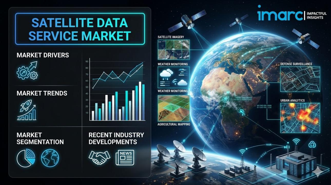
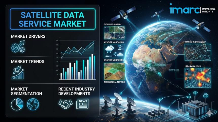
Market Overview:
The satellite data service market is experiencing rapid
growth, driven by expanding national security and defense requirements,
escalating demand for precision agriculture and resource management, and
integration of artificial intelligence in geospatial analytics. According
to IMARC Group's latest research publication, "Satellite Data
Service Market Size, Share, Trends and Forecast by Service, Application,
Vertical, and Region, 2026-2034", The global satellite data
service market size reached USD 12.1 Billion in 2025. Looking
forward, IMARC Group expects the market to reach USD 37.4 Billion by
2034, exhibiting a growth rate (CAGR) of 13.33% during
2026-2034.
This detailed analysis primarily encompasses industry size,
business trends, market share, key growth factors, and regional forecasts. The
report offers a comprehensive overview and integrates research findings, market
assessments, and data from different sources. It also includes pivotal market
dynamics like drivers and challenges, while also highlighting growth
opportunities, financial insights, technological improvements, emerging trends,
and innovations. Besides this, the report provides regional market evaluation,
along with a competitive landscape analysis.
Download a sample PDF of this report: https://www.imarcgroup.com/satellite-data-service-market/requestsample
Our report includes:
- Market
Dynamics
- Market
Trends and Market Outlook
- Competitive
Analysis
- Industry
Segmentation
- Strategic
Recommendations
Growth Factors in the Satellite Data Service Market
- Expanding
National Security and Defense Requirements
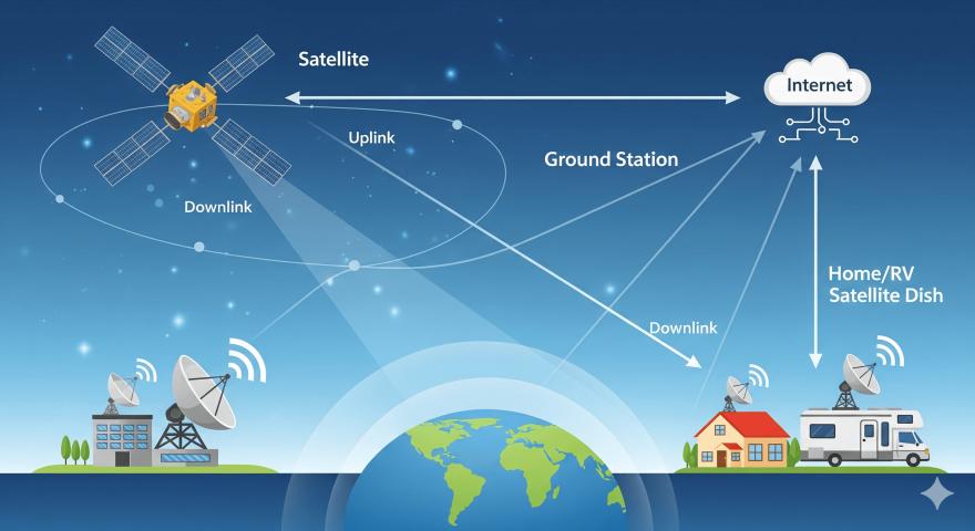
The global satellite imagedata service market is witnessing increasing demand for
high-resolution satellite imagery, primarily driven by national security
mandates and tactical geospatial intelligence. Government and military sectors
currently capture the highest share of the market, accounting for approximately
47.8% of total utilization in 2026. Defense agencies are shifting toward
persistent surveillance models to monitor border activities and potential
conflict zones in real time. For example, the United States Space Development
Agency is actively deploying its Transport Layer Tranche 1 program, creating a
low Earth orbit mesh network specifically for global military communications
and missile defense. This reliance on space-based data for situational
awareness is further evidenced by the rise in multispectral and hyperspectral
imaging, which allows for the detection of camouflaged assets and subtle
environmental changes. As geopolitical tensions necessitate more robust
monitoring, the integration of satellite data into military decision-making frameworks
remains a primary catalyst for expansion in the satellite image data service
market.
- Escalating
Demand for Precision Agriculture and Resource Management
The agricultural sector has become a vital consumer of
satellite data as farmers and governments seek to optimize food security and
resource efficiency. Precision agriculture techniques utilize
satellite-derived soil moisture levels, crop health indices, and weather
patterns to enhance yields and reduce waste. In 2026, organizations are
leveraging these insights to manage natural resources more effectively, with
environmental monitoring segments holding a substantial market share of over
34.56%. Commercial satellite operators like Planet Labs and Maxar Technologies
provide frequent revisit rates that allow for the tracking of vegetation health
and irrigation needs on a granular level. Furthermore, the Asia-Pacific
region is experiencing a surge in adoption, with countries like India and China
investing heavily in indigenous satellite capacity to support their massive
agricultural bases. This transition toward data-driven farming ensures
that satellite services remain indispensable for maintaining global supply
chain stability and sustainable land management.
- Integration
of Artificial Intelligence in Geospatial Analytics
Technological advancements in artificial intelligence and
machine learning are revolutionizing how vast quantities of raw satellite data
are processed and commercialized. The artificial intelligence segment
within the industry is expected to secure a market share of approximately
37.65% in 2026, as automated algorithms replace manual image interpretation. These
AI-driven platforms enable "change detection" at scale, allowing
users to automatically identify new construction, deforestation, or vehicle
movements across thousands of square miles. Leading firms are now offering
"insights-as-a-service," where customers receive actionable reports
rather than raw imagery. This trend is bolstered by the adoption of
cloud-native data centers that facilitate the rapid ingestion of petabytes of
information. By reducing the time required to extract value from
space-borne sensors, AI integration is attracting a broader range of commercial
end-users, from retail analysts tracking parking lot occupancy to insurance
companies assessing post-disaster property damage.
Key Trends in the Satellite Data Service Market
- The
Proliferation of SmallSat and CubeSat Constellations
A significant shift is occurring as the industry moves away
from large, expensive geostationary satellites toward massive constellations of
small, low-cost satellites. These SmallSats operate in low Earth orbit,
providing much lower latency and significantly higher revisit frequencies
compared to traditional hardware. In 2026, this trend is highlighted by
companies like Satellogic, which recently entered into multi-million-dollar
agreements to grant customers flexible access to its NewSat constellation. These
networks allow for "near-real-time" monitoring of the Earth's
surface, with some constellations capable of imaging the same location multiple
times per day. This high-cadence data is crucial for dynamic applications
such as tracking active wildfires or monitoring maritime traffic in busy
shipping lanes. The lower cost of manufacturing and launching these smaller
units has democratized access to space data, enabling startups and smaller
nations to maintain their own dedicated orbital assets for localized observation
and research.
- Emergence
of Satellite-to-Cell Connectivity
One of the most transformative trends in 2026 is the
convergence of satellite services with terrestrial mobile networks, commonly
referred to as satellite-to-cell technology. This innovation allows
standard smartphones to connect directly to satellites without the need for
specialized hardware or bulky antennas. T-Mobile has recently confirmed
the expansion of its T-Satellite network to include full data services as of
October 2026, following an initial rollout focused on messaging. This
trend addresses the "digital divide" by providing uninterrupted
connectivity in remote or underserved areas where traditional cell towers are
non-existent. For the satellite data market, this means a massive influx
of new telemetry and user-generated data points that can be analyzed for
logistics and consumer behavior. The integration with 5G systems ensures
that satellite data becomes a seamless part of the global telecommunications
infrastructure, supporting everything from emergency response in wilderness
areas to global asset tracking.
- Advancements
in Synthetic Aperture Radar (SAR) Accessibility
While optical imagery remains popular, there is a rapidly
growing trend toward the use of Synthetic Aperture Radar (SAR), which can
"see" through clouds, smoke, and darkness. Unlike optical
sensors that require sunlight, SAR uses microwave signals to map the Earth's
surface in all weather conditions. In 2026, SAR imagery is being used
extensively for disaster monitoring, such as mapping the extent of floods
during heavy rain or tracking ground subsidence in urban areas. NASA’s
Earth Science Data Systems have recently enhanced global flood products by
utilizing SAR data to distinguish between recurring and unusual flooding
events. This trend is particularly important for regions like Southeast Asia,
where frequent cloud cover often renders optical satellites ineffective. The
ability to maintain a consistent data stream regardless of atmospheric
conditions is making SAR an essential tool for high-stakes industries like oil
and gas, infrastructure development, and humanitarian relief.
Leading Companies Operating in the Global Satellite Data
Service Industry:
- Airbus
SE
- Ceinsys
Tech Limited
- Geospatial
Intelligence Pyt. Ltd.
- Gisat
S.R.O.
- ICEYE
- L3harris
Technologies Inc.
- Maxar
Technologies Inc.
- Planet
Labs Inc.
- Satellite
Imaging Corporation
- Telstra
Corporation Limited
- Trimble
Inc.
- Ursa
Space Systems Inc.
Satellite Data Service Market Report Segmentation:
By Service:
- Data
Analytics
- Image
Data
Image data leads the market with around 75.6% of the market
share in 2024, focusing on providing raw and processed imagery for applications
like environmental monitoring and military reconnaissance.
By Application:
- Scientific
- Administrative
- Commercial
The scientific application segment is driven by the need for
high-precision data in earth and space sciences for research purposes such as
climate change studies and atmospheric monitoring.
By Vertical:
- Defence
and Security
- Energy
and Power
- Agriculture
- Environmental
- Engineering
and Infrastructure
- Marine
- Others
The environmental segment leads the market in 2024, focusing
on monitoring natural resources and ecosystems, providing real-time data for
informed decision-making on environmental protection and sustainability.
Regional Insights:
- North
America (United States, Canada)
- Asia
Pacific (China, Japan, India, South Korea, Australia, Indonesia, Others)
- Europe
(Germany, France, United Kingdom, Italy, Spain, Russia, Others)
- Latin
America (Brazil, Mexico, Others)
- Middle
East and Africa
In 2024, North America accounted for over 36.8% of the
market share due to its advanced technological infrastructure, significant
investments in R&D, and reliance on innovative solutions in key industries.
Note: If you require specific details, data, or insights
that are not currently included in the scope of this report, we are happy to
accommodate your request. As part of our customization service, we will gather
and provide the additional information you need, tailored to your specific
requirements. Please let us know your exact needs, and we will ensure the
report is updated accordingly to meet your expectations.
About Us:
IMARC Group is a global management consulting firm that
helps the world’s most ambitious changemakers to create a lasting impact. The
company provide a comprehensive suite of market entry and expansion services.
IMARC offerings include thorough market assessment, feasibility studies,
company incorporation assistance, factory setup support, regulatory approvals
and licensing navigation, branding, marketing and sales strategies, competitive
landscape and benchmarking analyses, pricing and cost research, and procurement
research.
Contact Us:
IMARC Group
134 N 4th St. Brooklyn, NY 11249, USA
Email: sales@imarcgroup.com
Tel No:(D) +91 120 433 0800
United States: +1-201971-6302