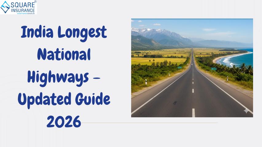
India’s road network is one of the largest in the world. If you’ve ever taken a long road trip—from the mountains of Jammu & Kashmir to the beaches of Tamil Nadu—you’ve probably traveled on one of the Longest National Highways In India without even realizing it.
Many people search for the longest
highway in India out of curiosity. Some want to plan a road trip. Others are
preparing for competitive exams. And some simply love learning how India stays
connected through its vast road network.
In this updated 2026 guide, you’ll
learn:
- Which is the longest national highway in India
- The top longest highways and the states they cover
- Interesting facts about major routes
- Why these highways matter for travel and trade
Let’s begin with the highway that
stretches almost the entire length of India.
What Are National Highways in India?
National Highways (NH) are major
roads maintained by the central government. They connect:
- Big cities
- State capitals
- Industrial hubs
- Ports and border areas
Even though national highways make
up only around 2% of India’s total road network, they carry nearly 40% of the
country’s traffic. That shows how important they are.
These highways are managed mainly by
the National Highways Authority of India (NHAI) and the Ministry of Road
Transport and Highways.
Which Is the Longest National Highway in India?
NH
44 – The Longest National Highway in India
The title of the longest national
highway in India goes to National Highway 44 (NH 44).
- Total Length:
Approx. 3,745 km
- Start Point:
Srinagar (Jammu & Kashmir)
- End Point:
Kanyakumari (Tamil Nadu)
This highway connects the
northernmost part of India to its southern tip. It passes through several
states, including:
- Jammu & Kashmir
- Punjab
- Haryana
- Delhi
- Uttar Pradesh
- Madhya Pradesh
- Maharashtra
- Telangana
- Andhra Pradesh
- Karnataka
- Tamil Nadu
If you drive the entire NH 44, you
experience almost every type of Indian landscape—snow-covered mountains,
plains, forests, and coastal roads.
Top Longest National Highways In India (Updated 2026)
Let’s look at other major highways
that are among the longest in India.
1.
NH 27 – East to West Connector
- Length:
Around 3,507 km
- Start:
Porbandar (Gujarat)
- End:
Silchar (Assam)
NH 27 connects western India to the
northeast. It passes through states like Gujarat, Rajasthan, Uttar Pradesh,
Bihar, West Bengal, and Assam.
This highway plays a key role in
linking remote northeastern states to the rest of the country.
2.
NH 48 – Major Economic Corridor
- Length:
Approx. 2,807 km
- Start:
Delhi
- End:
Chennai
NH 48 connects major business cities
like Delhi, Jaipur, Ahmedabad, Mumbai, Pune, Bengaluru, and Chennai.
It is one of the busiest highways in
India. If you’ve traveled between Delhi and Mumbai by road, chances are you
were on NH 48.
3.
NH 52 – Central India Stretch
- Length:
Around 2,317 km
- Start:
Punjab
- End:
Karnataka
NH 52 runs across central India and
supports both agriculture and industrial transport.
4.
NH 30 – Historic and Cultural Route
- Length:
Approx. 2,040 km
- Start:
Uttarakhand
- End:
Andhra Pradesh
This route passes through culturally
rich cities like Lucknow and Raipur.
Why Are Long National Highways Important?
The Longest National Highways In
India are not just long roads—they are lifelines.
1.
Boost to Trade and Economy
Goods move across states through
trucks every day. Long highways reduce travel time and fuel costs.
For example:
- Fruits from Maharashtra reach Delhi faster.
- Industrial goods from Gujarat move to southern ports
easily.
This smooth movement supports
business growth.
2.
Better Connectivity
These highways connect remote towns
to big cities. This helps with:
- Tourism
- Medical emergencies
- Education access
- Job opportunities
Imagine someone in a small town in
Madhya Pradesh needing to travel to Delhi for treatment. Highways make that
journey easier and faster.
3.
National Integration
When highways connect north to south
and east to west, they strengthen national unity. They allow people, culture,
and ideas to move freely across states.
Interesting Facts About India’s Longest Highways
Here are some lesser-known insights:
- NH 44 was formed after the renumbering of highways in
2010–2011.
- Many long highways are part of the Golden Quadrilateral
and Bharatmala projects.
- Some highways include tunnels and expressway stretches
for smoother travel.
- The Delhi–Mumbai stretch of NH 48 is among the busiest
road corridors in India.
Road Trip Experience on NH 44
If you ever plan a long road trip in
India, NH 44 offers a unique experience.
You could start from Srinagar, pass
through the plains of Punjab, explore Delhi’s urban stretch, drive through
central India’s forests, and finally reach the coastal beauty of Kanyakumari.
However, long-distance travel also
requires planning:
- Check vehicle condition
- Plan fuel stops
- Track toll plazas
- Carry emergency supplies
Long highways are smooth, but
traffic and weather conditions can vary.
Safety Tips for Long Highway Travel
Since the Longest National
Highways In India cover thousands of kilometers, safety becomes crucial.
Here are practical tips:
- Avoid driving continuously for more than 3–4 hours
without a break
- Follow speed limits strictly
- Use FASTag for smooth toll payments
- Keep your vehicle insured and documents updated
- Avoid night driving in unfamiliar rural stretches
Highways may look empty at times,
but sudden cattle crossings or heavy trucks can appear unexpectedly.
Upcoming Developments in 2026
India continues to expand and
upgrade its highway network.
Key developments include:
- Expansion of 4-lane and 6-lane highways
- Better roadside facilities
- Electric vehicle charging stations along major
corridors
- Smart traffic monitoring systems
These improvements are making long
highway travel safer and faster.
How Are National Highways Numbered?
After 2010, India introduced a new
numbering system:
- Even numbers: East–West highways
- Odd numbers: North–South highways
For example:
- NH 44 runs north to south (odd number).
- NH 27 runs east to west (even number).
This system makes it easier to
understand the direction of the highway.
Conclusion
India’s highway network is more than
just asphalt and concrete. The Longest National Highways In India
connect diverse cultures, support businesses, and make long-distance travel
possible. Whether you're planning a cross-country road trip or transporting
goods between states, staying prepared with proper vehicle protection from
providers like square insurance adds an extra layer of confidence to
every journey.
NH 44 stands as the longest highway,
stretching from the Himalayas to the Indian Ocean. Other long routes like NH 27
and NH 48 also play a major role in linking major cities and economic hubs,
helping millions of travelers and busin esses
move safely and efficiently across the country.
Frequently Asked Questions
1.
Which is the longest national highway in India in 2026?
NH 44 is the longest national
highway in India, with a length of about 3,745 km.
2.
How many states does NH 44 pass through?
NH 44 passes through around 11
states, connecting Srinagar to Kanyakumari.
3.
Which highway connects east to west India?
NH 27 is one of the longest
east–west highways, connecting Gujarat to Assam.
4.
Why are national highways important?
They support trade, improve
connectivity, reduce travel time, and strengthen the economy.
5.
What is the difference between a highway and an expressway?
National highways may have
intersections and mixed traffic, while expressways are controlled-access roads
designed for high-speed travel.