When winter weather is in the forecast, one question quickly becomes more important than how much snow is expected: Will school actually close?
The answer is rarely based on snowfall totals alone. School districts consider a combination of weather conditions, road safety, transportation, timing, and local circumstances before deciding whether to open normally, delay the start, or close completely.
That is why predicting a snow day requires looking at more than the number of inches in a forecast.
A snow day calculator can help organize those factors into a practical estimate, but understanding what goes into the prediction can make the result much more useful.
Snowfall Is Important, But It Isn't Everything
Snow accumulation is one of the most obvious factors in a potential school closure.
A forecast calling for several inches of snow overnight may create difficult conditions for morning commuters and school buses. However, the same amount of snow can produce very different outcomes depending on where and when it falls.
For example, a community that regularly handles significant snowfall may have extensive plowing equipment and established winter procedures. Another area that receives snow less frequently may experience much greater disruption from a smaller storm.
This means there is no universal snowfall amount that automatically creates a snow day.
Instead of asking only, "How many inches will we get?" it is more useful to ask:
- How quickly will the snow accumulate?
- Will it fall overnight or during the morning commute?
- Will roads be cleared before buses begin their routes?
- Will temperatures remain below freezing?
- Is ice or freezing rain expected?
- Will wind reduce visibility or cause drifting?
These questions provide a much better picture of potential school disruption.
Storm Timing Can Change Everything
Timing is one of the most important parts of a snow-day forecast.
Imagine two storms that each produce six inches of snow. In the first scenario, the snow falls gradually throughout the day and ends several hours before sunrise. Road crews have time to plow and treat major routes.
In the second scenario, the same six inches falls between midnight and 7 a.m.
The second storm could create much more difficult conditions for school transportation because the heaviest accumulation occurs immediately before buses and families need to travel.
This is why hourly forecasts can be more useful than looking only at a daily snowfall total.
When checking the possibility of a snow day, pay particular attention to the hours leading up to the normal school commute.
Temperature and Ice Risk Matter Too
Snow is not the only winter hazard.
Temperatures around the freezing point can create complicated conditions because precipitation may change between snow, sleet, freezing rain, and ordinary rain.
Freezing rain can be especially disruptive because even a relatively small amount can create hazardous roads, sidewalks, parking lots, and bridges.
Cold temperatures can also affect school decisions independently of snowfall. Extremely low temperatures may create additional concerns for students waiting for buses, walking to school, or traveling along exposed roads.
A useful snow-day prediction therefore considers temperature alongside precipitation rather than treating snowfall as an isolated number.
Wind and Visibility Can Affect School Transportation
Strong winds can make a winter storm more difficult to manage even when snowfall totals are moderate.
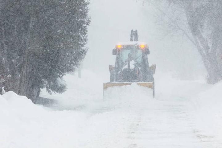
Wind can blow loose snow across roads, create drifting, and reduce visibility for drivers. During heavier snow, visibility can deteriorate rapidly, making transportation more difficult.
For school districts, this matters because buses travel on a wide range of roads. Rural routes, open areas, hills, and less-traveled roads may experience conditions that are very different from those on major city streets.
When evaluating a potential snow day, consider both the amount of snow and the conditions students and drivers are likely to encounter during the morning transportation window.
Why Local Conditions Matter
Weather forecasts cover broad areas, but school decisions are local.
Two districts located only a few miles apart can sometimes make different decisions because of differences in:
- Road networks
- Elevation
- Bus routes
- Plowing resources
- School policies
- Traffic patterns
- Rural versus urban geography
- Local temperatures
- Previous winter weather conditions
This is one reason a general weather app cannot tell you with certainty whether your particular school will close.
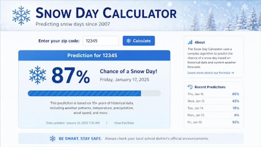
A location-based Snow Day Predictor can be useful because it brings several forecast variables together for a specific area. Rather than focusing exclusively on snowfall, a multi-factor approach can consider snow, temperature, precipitation type, wind, visibility, and other conditions relevant to school transportation.
How to Use a Snow Day Predictor
A snow-day prediction is most useful when treated as a planning tool rather than an official announcement.
Start by entering the location that best represents your school or district. Depending on the calculator, this may be a city, ZIP code, postal code, or GPS location.
Then look beyond the headline probability.
A good prediction should help explain why the risk is elevated or reduced. For example, a higher closure estimate may be associated with heavy overnight snow, freezing conditions, poor visibility, or a combination of several factors.
This explanation is important because weather conditions can change quickly.
If a storm's expected track shifts or temperatures rise above freezing, the potential impact on roads may change even if the original snowfall forecast looked significant.
When Should You Check the Prediction?
There is little value in checking a snow-day prediction once and assuming it will remain unchanged.
Forecast models are updated as new information becomes available, so conditions can change as a storm approaches.
A practical routine is to check:
The day before:
Look at the overall storm forecast and expected timing.
Before bedtime:
Review updated snowfall totals, precipitation type, wind, and overnight temperatures.
Early in the morning:
Check the latest forecast and actual road conditions before making transportation plans.
After an official alert:
Recheck the forecast and follow instructions from your school district and local authorities.
The closer you get to the school commute, the more useful current observations and updated forecasts become.
Snow Day Predictions Are Estimates, Not Guarantees
Even an advanced weather-based calculator cannot know exactly what a school superintendent will decide.
District officials may consider information that a public calculator cannot access, including current road reports, bus driver feedback, staffing, municipal plowing operations, school building conditions, and district-specific policies.
For that reason, a prediction should never replace an official school announcement.
Instead, use it to understand the weather situation and prepare for different possibilities.
If the forecast indicates significant overnight snow and dangerous temperatures, for example, families can prepare transportation alternatives, adjust morning schedules, or make sure children have appropriate winter clothing.
What About a Two-Hour Delay?
Not every difficult winter morning results in a full school closure.
Some districts may choose a delayed opening when conditions are expected to improve after sunrise. A delay can give road crews additional time to clear routes and allow temperatures to rise before buses begin operating.
This is why it can be helpful to distinguish between closure risk and delay risk.
A storm producing moderate snow overnight but improving before the normal commute may create conditions that support a late start rather than a complete cancellation.
Looking at both possibilities gives families a more realistic picture of what could happen.
Don't Focus on One Number
The biggest mistake people make when trying to predict a snow day is looking for one magic number.
There is no universal snowfall threshold that guarantees school closure.
Three inches can create major problems under the right circumstances. Six inches may be manageable in another location. A thin layer of freezing rain can sometimes cause more transportation problems than several inches of powder.
The more useful approach is to consider the complete weather picture:
Snow + ice + temperature + wind + visibility + timing + road conditions + local policy
Together, these factors provide much more context than snowfall totals alone.
Final Thoughts
Predicting a snow day is ultimately an exercise in understanding risk.
Weather forecasts can show what conditions are expected, while a snow-day calculator can organize those conditions into an easy-to-understand estimate. But the final decision belongs to the school district.
If winter weather is approaching, start with the forecast, check how conditions are expected to develop overnight, and use a location-specific Snow Day Predictor to understand the potential impact on your area.
Most importantly, check your school district's official communication channels before assuming that school is closed or delayed.
A prediction can help you prepare. The official announcement is what determines the school schedule.