Cities were once learned slowly. People memorized streets by walking them, asking for directions, or following landmarks passed down through stories and habits. Getting from one place to another meant knowing the city, not just living in it. Today, that relationship has changed. Cities are no longer only physical spaces; they are digital experiences layered over roads, buildings, and neighborhoods. Taxi apps sit at the center of this shift, turning complex urban environments into simple, interactive maps that anyone can navigate with a tap.
This transformation did not happen overnight. It grew from a simple need: helping people move through cities without confusion. Over time, taxi apps evolved into tools that reshape how people understand distance, time, and location. Streets became lines, traffic became colors, and destinations became clickable points. In many ways, taxi apps have taught people to see cities differently—not as confusing grids, but as organized systems that respond instantly to their needs.
Behind this change, a Taxi App Development company plays a quiet but powerful role, designing platforms that translate real-world movement into digital clarity. These apps do more than book rides; they map the city in real time and make it usable for millions of people every day.
When Cities Became Digital Interfaces
Before taxi apps, city navigation relied heavily on personal experience. Locals knew shortcuts, while newcomers often felt lost. Maps existed, but they were static and limited. Taxi apps changed this by making maps live and responsive. Roads update as traffic changes. Routes adjust as conditions shift. The city becomes a moving interface rather than a fixed layout.
This shift matters because cities are no longer predictable. Construction, congestion, events, and weather can alter travel at any moment. Taxi apps respond instantly, turning unpredictable environments into manageable journeys. The city stops feeling overwhelming and starts feeling readable.
From Addresses to Actions
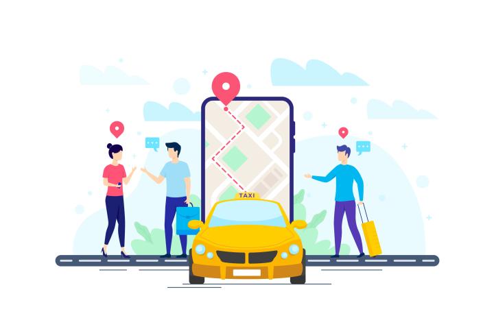
In the past, an address was just information. Today, it is an action. When someone taps a location in a taxi app, that point triggers a chain of events—driver matching, route calculation, fare estimation, and arrival prediction. The city becomes clickable, not just viewable.
This simple change has deep effects. People no longer think in terms of routes; they think in outcomes. “How do I get there?” becomes “How fast can I arrive?” Taxi apps remove the need to plan paths, allowing users to focus on purpose rather than process.
How Real-Time Mapping Changed Urban Behavior
Real-time maps influence how people behave in cities. When users can see traffic, estimated arrival times, and nearby drivers, they make faster decisions. Meetings are scheduled with confidence. Social plans become more flexible. Even last-minute travel feels manageable.
Over time, this leads to a cultural shift. People expect cities to respond instantly. Waiting without information feels unacceptable. Taxi apps meet this expectation by keeping users informed at every step. This constant feedback loop builds trust between the user and the city itself.
Data Turns Streets into Smart Paths
Every ride adds to a growing pool of location data. This data shows which roads slow down at certain times, where demand spikes occur, and which routes perform best under pressure. Taxi apps use this information to improve routing and reduce delays.
What makes this powerful is that the map is never finished. It evolves with every journey. A street is not just a street; it is a data point shaped by thousands of past trips. As a result, cities become smarter not through construction alone, but through usage patterns captured digitally.
Navigation Without Local Knowledge
One of the biggest changes taxi apps introduced is equal access to city navigation. You no longer need to know the city to move through it efficiently. A visitor and a local can have nearly the same travel experience.
This levels the urban playing field. Tourists feel more confident exploring new areas. New residents settle in faster. Even longtime locals discover better routes they may never have tried. The city opens up, not just geographically, but socially.
Visual Simplicity Hides Deep Complexity
Taxi app maps look simple, but they are built on complex systems. Behind each clean interface is a constant flow of calculations—traffic speed, driver availability, route efficiency, and user preferences. The goal is to hide complexity while delivering clarity.
In the middle of this technical balance, many platforms rely on an experienced iphone app development company to ensure maps load smoothly, gestures feel natural, and updates happen without delay. When maps feel effortless, users trust them more, even without understanding the technology underneath.
Turning Waiting Time into Visible Time
One of the most stressful parts of city travel used to be waiting. People stood on sidewalks unsure if help was coming. Taxi apps transformed waiting into visible progress. Users watch the driver approach in real time, turning uncertainty into reassurance.
This changes how time is perceived. A five-minute wait feels shorter when movement is visible. The city feels active, responsive, and alive. Maps are no longer passive displays; they are storytellers showing progress step by step.
Safety Through Visibility
Maps also play a role in safety. Knowing where a vehicle is, which route it is taking, and how long the journey will last gives users a sense of control. This is especially important in unfamiliar areas or late at night.
Taxi apps make journeys transparent. Nothing feels hidden. This visibility builds confidence and encourages people to move more freely within the city. Safety, in this sense, is supported not only by policies but by clear, real-time information.
How Drivers Experience the Clickable City
Taxi apps do not only change how passengers see cities; they change how drivers experience them too. Drivers receive optimized routes, demand insights, and navigation assistance. The city becomes less about guesswork and more about efficiency.
Drivers learn which areas are active, when demand rises, and how to avoid delays. Over time, they interact with the city as a system rather than a maze. This improves service quality and reduces stress for both drivers and passengers.
Cities as Living Systems, Not Static Places
Taxi apps reveal a new truth about cities: they are living systems. Traffic flows like water. Demand pulses like a heartbeat. Maps capture these patterns and display them in real time.
This understanding influences city planning as well. Aggregated data highlights underserved areas and peak congestion points. While taxi apps are not urban planners, their insights help shape better decisions about mobility and access.
The Economic Layer of Clickable Maps
Clickable maps also support local economies. Businesses become easier to reach. New neighborhoods gain visibility. When destinations are simple to tap and travel to, people explore more and spend more locally.
Small shops benefit when customers can arrive without hassle. Events see better attendance when transport feels reliable. Over time, taxi apps help distribute economic activity more evenly across the city.
Why Simplicity Keeps Users Loyal
The success of taxi apps lies in simplicity. Users do not want to think about maps, routes, or traffic. They want results. A clear interface, accurate map, and predictable outcome keep people coming back.
When apps deliver this consistently, users stop seeing them as tools and start seeing them as extensions of the city. The map becomes familiar, almost comforting, like a trusted guide through urban life.
The Future of Cities as Clickable Experiences
As technology advances, taxi apps will likely deepen their role in city navigation. Smarter predictions, cleaner transport options, and better integration with public systems will make maps even more responsive.
Cities will feel less fragmented. Movement will feel smoother. The idea of getting lost may fade entirely as clickable maps guide people effortlessly from start to finish.
Final Thoughts: When Cities Respond to a Tap
Taxi apps have quietly changed how people understand and interact with cities. By turning streets into clickable maps, they replaced confusion with clarity and hesitation with confidence. Cities are no longer just places people live in; they are systems people interact with in real time.
As these platforms continue to grow, the focus will remain on building reliable, intuitive experiences. Partnering with the right mobile app Development Company ensures that these digital maps stay fast, accurate, and scalable as cities evolve. In the end, the true power of taxi apps lies not in moving people, but in helping them see the city as something they can understand, trust, and navigate with ease.
Frequently Asked Questions
1. What does it mean when cities become “clickable maps”?
Ans: It means people can interact with the city through digital maps. By tapping a location, they can instantly plan and start a journey, making city navigation faster and easier.
2. How do taxi apps help people understand city routes better?
Ans: Taxi apps show live traffic, estimated arrival times, and the best routes in real time. This helps users move around the city without needing local knowledge.
3. Why are real-time maps important for urban travel?
Ans: Real-time maps adjust to traffic, roadblocks, and demand changes. This keeps journeys smooth and reduces delays, especially in busy city areas.
4. Do taxi apps improve safety in cities?
Ans: Yes, they make trips more transparent. Users can see vehicle movement, routes, and arrival times, which helps them feel more secure during travel.
5. How do taxi apps help people who are new to a city?
Ans: They remove confusion by guiding users step by step. New residents and visitors can explore confidently without worrying about directions or routes.