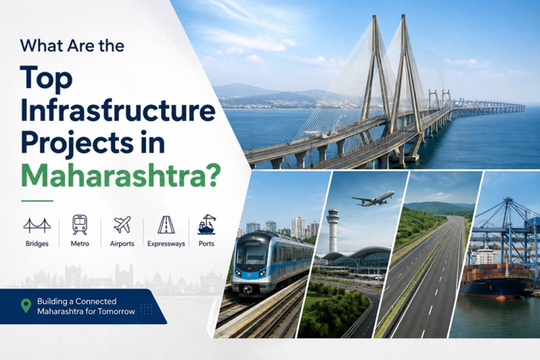
Maharashtra is witnessing major investment in roads, bridges, metro systems, airports, high-speed rail and maritime infrastructure. Some of the most significant projects include the Mumbai Trans Harbour Link, Navi Mumbai International Airport, Mumbai Metro expansion, Mumbai-Ahmedabad High-Speed Rail, Mumbai Coastal Road, Maharashtra Samruddhi Mahamarg, Pune Metro, Pune Ring Road and Vadhvan Port.
The scale of this transformation is visible in the numbers. Atal Setu is a 21.8-km, six-lane bridge with an approved project cost of ₹17,843 crore. The Mumbai-Ahmedabad High-Speed Rail corridor spans 508 km. Pune Metro currently covers 33.1 km across two lines and 30 stations. The Samruddhi Mahamarg extends for 701 km across Maharashtra. Official project authorities and government departments provide the latest information on construction progress, costs and operational status.
This overview is based on information published by the Maharashtra government, MMRDA, MSRDC, CIDCO, BMC, Maha Metro, JNPA and the Government of India. Project status and figures should be read according to the latest updates issued by the respective authorities.
Also Read : Challenges Faced by Civil Engineers on Large Infrastructure Projects
What Major Infrastructure Projects Are Underway in Maharashtra?
Maharashtra's infrastructure programme covers several transport modes. Mumbai and the Mumbai Metropolitan Region account for a large share of metro, road, bridge and airport projects. Pune is expanding its metro and regional road network. Nagpur and eastern Maharashtra benefit from the Samruddhi Mahamarg and its connections. Maritime projects such as Vadhvan Port are also planned to strengthen the state's role in national and international logistics.
The projects serve different purposes. Some improve daily commuting. Others support long-distance road travel, freight movement, aviation or port connectivity. Their combined effect is a shift towards a more connected road, rail, airport and logistics network.
1. What Is the Mumbai Trans Harbour Link?
The Mumbai Trans Harbour Link, officially called the Atal Bihari Vajpayee Sewri-Nhava Sheva Atal Setu, connects Sewri in Mumbai with Nhava Sheva in Navi Mumbai. According to the Mumbai Metropolitan Region Development Authority (MMRDA), the bridge is approximately 21.8 km long and has six lanes. About 16.5 km runs over the sea and about 5.5 km is on land. The approved total project cost is ₹17,843 crore. Construction started in March 2018 and was completed in January 2024.
Atal Setu was inaugurated on 12 January 2024 and opened to traffic on 13 January 2024. The bridge was developed to improve connectivity between Mumbai and the mainland, including Navi Mumbai and the wider Raigad region. It also provides a faster connection towards Navi Mumbai International Airport and improves links between Mumbai Port and Jawaharlal Nehru Port.
The project is important beyond its role as a bridge. It forms part of a wider regional network connecting Mumbai with Navi Mumbai, major highways, airports and logistics hubs.
2. Why Is Navi Mumbai International Airport Important?
Navi Mumbai International Airport is being developed as a major greenfield airport for the Mumbai Metropolitan Region. CIDCO was appointed by the Maharashtra government as the nodal agency for the airport's development. CIDCO's project documentation states that the airport is being developed in phases, with an ultimate projected capacity of 60 million passengers per annum.
The airport is important because Mumbai's aviation demand continues to grow while available land around the existing airport is constrained. A second major airport gives the metropolitan region additional passenger and cargo-handling capacity.
Its location also makes surface connectivity critical. Atal Setu provides a direct road connection between Mumbai and Navi Mumbai, while metro, road and rail projects are being planned or developed around the wider airport region. This makes the airport part of a larger transport network rather than an isolated aviation project.
3. How Is Mumbai's Metro Network Expanding?
Mumbai's metro expansion includes several corridors under different agencies. MMRDA's current project portfolio includes Metro Lines 2B, 4, 5, 6 and 9 & 7A, along with other transport and multimodal integration projects.
The scale of individual corridors shows how the network is being developed. Metro Line 2B between D.N. Nagar and Mandale is 23.643 km long with 20 stations. MMRDA lists an estimated project cost of ₹10,986 crore. The line is designed to connect with several existing and planned transport systems, including suburban rail and other metro corridors.
Metro Line 5 between Thane, Bhiwandi and Kalyan is 24.9 km long with 15 elevated stations. MMRDA lists its project base cost at ₹8,416.51 crore. The corridor is designed to connect with Metro Line 4, the proposed Metro Line 12 and the existing Central Railway network.
The wider metro programme is significant because Mumbai's transport demand cannot be addressed through roads alone. Better interchange between metro lines, suburban railways, buses and other modes is essential for creating a more integrated metropolitan transportation network.
4. What Is the Mumbai-Ahmedabad High-Speed Rail Project?
The Mumbai-Ahmedabad High-Speed Rail (MAHSR) project is India's first high-speed rail corridor under execution. The corridor is 508 km long and passes through Maharashtra, Gujarat and the Union Territory of Dadra and Nagar Haveli and Daman and Diu. Twelve stations are planned between Mumbai and Ahmedabad, including Mumbai, Thane, Virar, Boisar, Surat, Vadodara and Ahmedabad.
The project is being implemented with technical and financial assistance from the Government of Japan. As of March 2026, the Ministry of Railways reported that the entire 1,389.5 hectares required for the project had been acquired and all statutory clearances had been obtained. The same update reported 430 km of pier work, 341 km of girder work and 174 km of track-bed construction.
The project also involves major engineering works. The Mumbai section includes an underground station at Bandra-Kurla Complex, while an under-sea tunnel is part of the approach to Mumbai. The corridor is designed for high-speed trains operating at speeds of up to 320 km/h.
For Maharashtra, the corridor is significant because it strengthens the connection between Mumbai and major economic centres in Gujarat and western India.
5. How Will the Mumbai Coastal Road Improve Connectivity?
The Mumbai Coastal Road is a major urban road project along the city's western coastline. According to the Brihanmumbai Municipal Corporation (BMC), the southern section has a road length of 10.58 km and an eight-lane configuration. The project also includes twin tunnels measuring 3.45 km in total, interchanges, reclamation, a sea wall, promenade and public-space components. BMC's project documentation lists the cost at ₹12,721 crore, excluding rehabilitation, acquisition and landscaping.
The project is designed to provide an additional north-south road connection and reduce pressure on existing arterial routes. Its tunnels and interchanges are particularly important because they allow road traffic to move through a highly built-up part of Mumbai without depending entirely on surface roads.
The Coastal Road also needs to be viewed as part of a larger road network. Its effectiveness depends on connections with the Bandra-Worli Sea Link, existing arterial roads and other planned transport infrastructure.
6. Why Is the Samruddhi Mahamarg Important for Maharashtra?
The Hindu Hrudaysamrat Balasaheb Thackeray Maharashtra Samruddhi Mahamarg is a 701-km, six-lane, access-controlled greenfield expressway developed by the Maharashtra State Road Development Corporation (MSRDC). MSRDC's project documentation describes the corridor as a 701-km expressway and reported that 600 km had been opened when the document was issued.
The corridor connects the Mumbai Metropolitan Region with Nagpur and passes through 10 districts, 26 talukas and hundreds of villages. A Mumbai Port Authority master plan notes that the project is intended to reduce travel time between Mumbai and Nagpur from around 16 hours to about seven hours.
The expressway's importance extends beyond passenger travel. Faster road access supports freight movement between western Maharashtra, Marathwada and Vidarbha. It also creates better conditions for logistics facilities, warehousing, agricultural markets and industrial development along connected districts.
The project therefore represents a regional development corridor as much as a highway project.
7. How Is Pune Metro Changing Urban Transportation?
Pune Metro is a major public transportation project serving Pune and Pimpri-Chinchwad. The official Pune Metro website currently lists two lines, 30 stations and a network length of 33.1 km, with 29 stations shown as operational.
The original two corridors include the PCMC-Swargate route and the Vanaz-Ramwadi route. The network includes underground and elevated sections and connects residential areas with commercial, educational and employment centres.
Expansion remains important as Pune continues to experience population growth and traffic pressure. The approved Line 4 and Line 4A project, for example, is planned to cover 31.64 km and connect areas including Kharadi, Magarpatta, Hadapsar, Swargate, Warje and Khadakwasla.
The future role of Pune Metro will depend on its integration with buses, suburban rail, roads and other planned transit systems. Multimodal connections are essential if metro expansion is to reduce dependence on private vehicles.
8. What Mumbai Urban Transport Projects Are Being Developed?
Mumbai's transport system extends beyond metro construction. Suburban railways remain central to daily commuting, while the region is also receiving station upgrades, railway capacity improvements, signalling works and multimodal integration projects.
MMRDA's project list includes multimodal integration works for several metro lines. These projects are intended to improve connections between metro stations and other modes of transport.
This integration is important because passengers rarely use only one mode for an entire journey. A commuter might travel by bus to a metro station, use the metro for the main part of the journey and then switch to suburban rail or another local transport service.
The long-term success of Mumbai's urban infrastructure therefore depends on how well these systems work together.
9. Which Port Projects Are Strengthening Maharashtra's Maritime Infrastructure?
Maharashtra's long coastline gives ports an important role in trade and logistics. Jawaharlal Nehru Port Authority (JNPA) describes JNPA as a major container port connected to more than 200 ports worldwide.
One of the state's major future maritime projects is Vadhvan Port in Palghar district. The project is being developed by Vadhvan Port Project Limited, a special-purpose vehicle of JNPA and the Maharashtra Maritime Board, with JNPA holding 74% and the Maharashtra Maritime Board holding 26%.
JNPA states that Vadhvan is planned as a deep-draft greenfield port. Its documentation identifies a natural depth of around 20 metres offshore and states that the port is intended to handle large container, bulk and crude vessels. The port's proposed container capacity is expected to reach approximately 23.9 million TEUs by 2040 under the project's stated development plan.
The Union Cabinet approved the Vadhvan Port project in June 2024. Construction-related activity has since progressed, including the award of a ₹1,648-crore contract for near-shore reclamation and shore protection in December 2024.
The project is important because port capacity needs to be supported by strong road and rail connections. Efficient hinterland connectivity will determine how effectively the new port supports Maharashtra's manufacturing, logistics and export sectors.
10. What Is the Status of Pune's Ring Road Project?
Pune's rapid expansion has increased the need for roads that divert through-traffic away from congested urban areas. The Pune Ring Road is planned as a peripheral transport corridor around the city.
Recent Maharashtra government documentation provides a more detailed picture than the earlier broad estimate of a 170-km ring road. The state's Urban Development Department currently describes an 83.12-km Pune Inner Ring Road configuration, including 11 tunnels with a combined length of 12.62 km, 17 major bridges and nine interchanges. The project involves sections associated with MSRDC, PMC and PMRDA.
The state government has also approved financial support for land acquisition. A Maharashtra government resolution dated August 2024 records a ₹5,500-crore HUDCO loan guarantee for land acquisition for the Pune Ring Road's eastern section.
The ring-road network is intended to improve connections between highways, industrial areas, logistics facilities and developing residential zones. It is therefore an important part of Pune's wider regional transportation strategy.
Why Are Maharashtra's Infrastructure Projects Important?
Maharashtra has one of India's largest and most diverse economies. Mumbai is a major financial and commercial centre, while Pune has strong automotive, technology and manufacturing clusters. Nagpur has an important strategic position in central India, and the state's ports support domestic and international trade.
Infrastructure affects all of these economic activities. Roads influence freight movement. Metro systems affect daily commuting. Airports support passenger and cargo traffic. Ports connect businesses with national and international markets.
The projects also show why multimodal connectivity matters. Atal Setu connects Mumbai with Navi Mumbai and the wider mainland. Metro projects connect urban neighbourhoods with railway and road networks. Samruddhi Mahamarg provides an east-west road corridor. Vadhvan Port is being planned alongside road and rail connections to its hinterland.
The objective is not simply to build more infrastructure. The larger goal is to make different infrastructure systems work together.
How Are These Projects Changing Mumbai and Maharashtra?
The biggest change is the expansion of connectivity beyond traditional city centres.
Atal Setu has created a new Mumbai-Navi Mumbai road connection. Navi Mumbai International Airport adds long-term aviation capacity to the metropolitan region. Mumbai's metro expansion adds new public transport corridors. The Samruddhi Mahamarg connects the Mumbai region with Nagpur and districts across the state.
Pune is following a similar pattern. Metro expansion is being combined with ring-road and regional road development. The objective is to provide more options for commuters and freight traffic as the metropolitan area expands.
These projects also influence the location of future development. Improved highways can support logistics parks and industrial clusters. New metro stations can improve access to employment and commercial areas. Airport and port connectivity can encourage supporting businesses around major transport hubs.
The outcome will depend on more than project completion. Last-mile connectivity, interchange facilities, maintenance, affordability and effective land-use planning will also shape the benefits residents and businesses receive.
What Does the Future of Infrastructure in Maharashtra Look Like?
Maharashtra's next phase of infrastructure development is likely to focus increasingly on multimodal connectivity.
Airports need efficient road and public transport links. Ports require reliable highway and rail connections. Metro stations need convenient interchange facilities. Expressways become more valuable when they connect industrial areas, logistics centres, airports and ports.
Mumbai will remain a major focus because of its population density and economic importance. Pune, Nagpur, Navi Mumbai, Thane and other regional centres will also play an increasingly important role in the state's growth.
Official project updates show that Maharashtra's infrastructure programme is no longer limited to individual roads or isolated transport systems. It is becoming a larger network of bridges, expressways, metro corridors, airports, railways and ports.
The long-term impact will depend on how effectively these systems operate together. Strong multimodal integration will determine whether major infrastructure investments translate into shorter journeys, more efficient logistics and broader economic opportunities.
Conclusion
Maharashtra's major infrastructure projects are reshaping the state's transportation and logistics network. Atal Setu, Navi Mumbai International Airport, Mumbai Metro expansion, Mumbai-Ahmedabad High-Speed Rail, Mumbai Coastal Road, Samruddhi Mahamarg, Pune Metro, Pune Ring Road and Vadhvan Port each address a different infrastructure requirement.
The figures show the scale of the transformation. Atal Setu spans 21.8 km. The Mumbai-Ahmedabad High-Speed Rail corridor covers 508 km. Samruddhi Mahamarg extends 701 km. Pune Metro currently has a 33.1-km network, while Vadhvan Port is planned as a major deep-draft maritime facility.
These projects matter because infrastructure affects more than travel time. Better connections between cities, employment centres, airports, ports, industrial areas and logistics hubs can support economic activity across the state.
The next challenge is integration. Roads, railways, metros, airports and ports need to function as connected parts of one larger transportation and economic network. That will determine how much value Maharashtra gains from its current infrastructure investment.