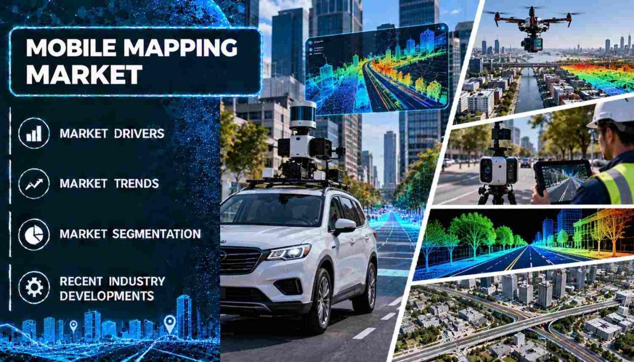
IMARC Group, a leading global market research and management consulting firm, has published its latest market intelligence report on the mobile mapping market. The global mobile mapping market grew from USD 45.7 Billion in 2025 to USD 52.5 Billion in 2026. Looking forward, IMARC Group estimates the market to reach USD 125.7 Billion by 2034, exhibiting a CAGR of 11.54% from 2026-2034. The market is witnessing steady expansion, with projections indicating strong upside. Growth is driven by widespread smartphone use and demand for location-based services, advances in GPS and GIS technology, rising infrastructure and smart city investment, and the growing need for high-definition maps in autonomous vehicles and advanced driver-assistance systems.
The mobile mapping market is gaining strong momentum as governments, utilities, transport agencies and automotive companies look for fast, accurate and repeatable ways to capture the physical world. Mobile mapping systems combine LiDAR scanners, GNSS receivers, inertial units and cameras on vehicles, drones, backpacks and handheld devices. They collect millions of survey-grade data points while moving, replacing slow, labor-intensive ground surveys. Hardware accounts for 55.0% of the market, because geospatial data capture depends on GPS receivers, laser scanners, cameras and sensors. Government end users lead demand with a 65.2% share, reflecting the scale of public infrastructure, urban planning and emergency response programs.
How AI is Reshaping the Future of the Mobile Mapping Market
Automated Feature Extraction from Point Clouds: Machine learning models can now classify road surfaces, lane markings, poles, signs, vegetation and building facades from raw LiDAR and imagery. Surveyors no longer have to digitize these features by hand. Highway authorities, utilities and city planners can turn corridor scans into asset inventories in a fraction of the time. This lowers the cost per mapped kilometer and shortens project turnaround.
AI-Enhanced Positioning in Difficult Environments: Positioning engines that fuse inertial data, satellite corrections and AI-based error mitigation are keeping centimeter-level accuracy in places where satellite signals weaken. These include urban canyons, tunnels and dense tree canopy. This broadens mobile mapping into dense city centers, forested corridors and mining sites where earlier systems struggled.
Continuous Map Updating for Autonomous Mobility: Autonomous vehicles and ADAS depend on high-definition maps that reflect current road conditions. AI-driven change detection compares new scans with existing map layers and flags construction zones, new signage or altered lane geometry. Map providers can then update specific segments instead of re-surveying whole networks.
Grab a sample PDF of this report: https://www.imarcgroup.com/mobile-mapping-market/requestsample
Mobile Mapping Market Trends and Drivers
The global mobile mapping market is witnessing steady expansion, supported by the convergence of smart city programs, vehicle automation, drone adoption and cloud-based geospatial platforms. Location intelligence has become basic infrastructure for governments and enterprises, and mobile mapping is the main way to build and refresh the underlying data.
Infrastructure and smart city investment is the most visible demand driver. In the United States, the Infrastructure Investment and Jobs Act commits about USD 1.2 Trillion across roads, bridges, transit and broadband. Programs of this size need accurate as-built records and condition surveys. India’s Smart Cities Mission covers 100 cities, and each city needs detailed geospatial layers for planning and utilities. In the United Kingdom, the Shared Prosperity Fund backed a mobile mapping project in Powys and Ceredigion in Wales. The project was run by Growing Mid Wales to find areas with poor mobile coverage. In the Middle East, giga-projects such as NEOM and large GCC construction programs rely on continuous geospatial capture.
Autonomous vehicles and ADAS are the second major force. High-definition maps with lane-level accuracy are a safety requirement for automated driving, not an add-on. Automakers, technology firms and mapping specialists are therefore investing in survey fleets and in partnerships with government agencies. These partnerships reduce duplicated data collection.
Technology improvements are also widening the user base. Better LiDAR, GPS and 5G connectivity enable real-time data collection and faster cloud processing. Drone-based mapping reaches difficult terrain that vehicles cannot. Augmented reality in gaming, real estate and tourism is also creating new demand for detailed 3D location data. The main restraint is cost. Mapping-grade hardware is expensive per unit and needs ongoing maintenance and upgrades. This pushes vendors toward lighter, more affordable systems and subscription-based software.
Ask an analyst for a customized report: https://www.imarcgroup.com/request?type=report&id=1394&flag=E
Mobile Mapping Industry Segmentation
The report has segmented the market into the following categories:
Breakup By Component:
- Hardware
- Software
- Services
Hardware holds the largest component share at 55.0%. Demand comes from GNSS receivers, laser scanners, cameras and inertial sensors, which are the core of any mobile mapping platform.
Breakup By Type:
- 3D Mapping
- Licensing
- Indoor Mapping
- Location Based Services
- Location Based Search
3D mapping leads with a 52.5% share. Cities, utilities and automotive developers increasingly need volumetric models, not flat maps, for planning, simulation and navigation.
Breakup By Application:
- Imaging Services
- Aerial Mobile Mapping
- Emergency Response Planning
- Internet Application
- Facility Management
- Satellite
Imaging services account for the largest application share at 47.5%. Street-level and panoramic imagery is widely used in asset management, insurance, real estate and consumer navigation.
Breakup By End-User:
- Government
- Oil and Gas
- Mining
- Military
- Others
Government is the largest end-user segment at 65.2%. Public agencies use mobile mapping for road inventories, urban planning, disaster management and defense.
Breakup By Region:
- North America (United States, Canada)
- Asia Pacific
- Europe
- Latin America
- Middle East and Africa
North America dominates with a 36.5% share, and the United States accounts for 80.0% of the regional market. Strong spending on highway and utility infrastructure, early adoption of autonomous vehicle programs and a mature geospatial industry support this position. Asia Pacific is a key growth area, driven by urbanization, smart cities, infrastructure build-out and 5G rollout. Europe is supported by smart city projects, autonomous vehicles and drones, and regulation on data accuracy and safety.
Competitive Landscape
The report provides a comprehensive analysis of the competitive landscape in the mobile mapping market, with detailed profiles of all major companies, including:
- Google LLC (Alphabet Inc.)
- Hexagon AB
- Trimble Inc.
- Topcon Corporation
- Javad GNSS Inc.
- OpTech LLC
- Mitsubishi Corporation
- Cyclomedia Technology B.V.
- EveryScape Inc.
What Does The Full Report Cover?
If you are tracking the mobile mapping market for investment decisions, market entry planning, competitive benchmarking or strategic advisory, IMARC Group’s full mobile mapping market report gives you everything in one place:
- Complete market sizing with revenue projections across the full outlook period
- Quantified growth driver analysis across component, type, application, end-user and regional markets
- Sub-segment breakdowns for hardware, software, services, 3D mapping, indoor mapping, imaging services and government, oil and gas, mining and military end users, with individual share data
- Country-level data for key markets across North America, Asia Pacific, Europe, Latin America, and the Middle East and Africa
- Competitive profiles of leading companies with strategic landscape assessment
- Porter’s Five Forces, value chain analysis and pricing intelligence
- Latest innovation trends covering LiDAR advances, drone-based mapping, cloud mapping platforms and AI-assisted data processing
Recent News and Developments in Mobile Mapping Market
- October 2025: Trimble announced next-generation Applanix mobile mapping portfolios at INTERGEO. The launch includes the POS LVX+ family of six models for land-based mapping and the POS AVX RTX family of four variants for airborne mapping. The land systems use the IN-Fusion+ inertial engine to hold performance in urban canyons and under tree canopy. The airborne systems reach up to 0.03 m horizontal and 0.06 m vertical RMS accuracy without extra base stations.
- May 2025: Leica Geosystems, part of Hexagon, launched the Leica Pegasus TRK300. The system uses a multi-beam scanner with two scanning heads and a range of up to 300 metres. It has a seven-hour battery life and is light enough for one person to carry and mount on a vehicle. It is designed to bring advanced mobile mapping to a wider range of users, from asset mapping to smart city modeling.
- July 2024: GeoCue released TrueView GO, a handheld mapping system available in 16-channel and 32-channel models, aimed at users who need flexible mapping without vehicle-mounted equipment.
- June 2024: Growing Mid Wales began a mobile mapping project in Powys and Ceredigion to identify areas with poor mobile coverage. The project was funded by the UK Shared Prosperity Fund.
- March 2024: Trimble introduced the MX90, an integrated mobile mapping system that can capture data at highway speed.
Note: If you require specific details, data or insights that are not currently included in the scope of this report, we are happy to accommodate your request. As part of our customization service, we will gather and provide the additional information you need, tailored to your specific requirements. Please let us know your exact needs, and we will ensure the report is updated accordingly.
Key Questions This Report Answers
- What is the current global mobile mapping market size and what is its projected value?
- Which component segment holds the largest share in the global mobile mapping market?
- What are the key drivers of global mobile mapping market growth?
- Which region dominates the global mobile mapping market and why?
- How are autonomous vehicles, smart city programs, drone mapping and AI-assisted processing reshaping product development and competitive strategies in the industry?
- Who are the top companies in the global mobile mapping market and what are their competitive strategies?
- What are the investment and market entry opportunities across 3D mapping, indoor mapping, imaging services and government-led infrastructure programs?
About Us
IMARC Group is a global management consulting firm that helps the world’s most ambitious changemakers to create a lasting impact. The company provides a comprehensive suite of market entry and expansion services. IMARC offerings include thorough market assessment, feasibility studies, company incorporation assistance, factory setup support, regulatory approvals and licensing navigation, branding, marketing and sales strategies, competitive landscape and benchmarking analyses, pricing and cost research, and procurement research.
Media and Sales Contact
IMARC Group
Email: sales@imarcgroup.com
United States: +1-201-971-6302
India: +91-120-433-0800
United Kingdom: +44-753-714-6104